

During the Expedition, 8 substations, at varying elevations (3 in the Crocker Range Park, 5 in Kinabalu Park) will be visited by the teams of scientists. Other substations in both parks will be on stand-by for ad-hoc visits by expedition participants. All substations have electricity and running water. All substations except Layang-Layang and Laban Rata are accessible by road. An estimate of the travel times between the 8 substations is given below:

Below follow brief descriptions of the Expedition sites:
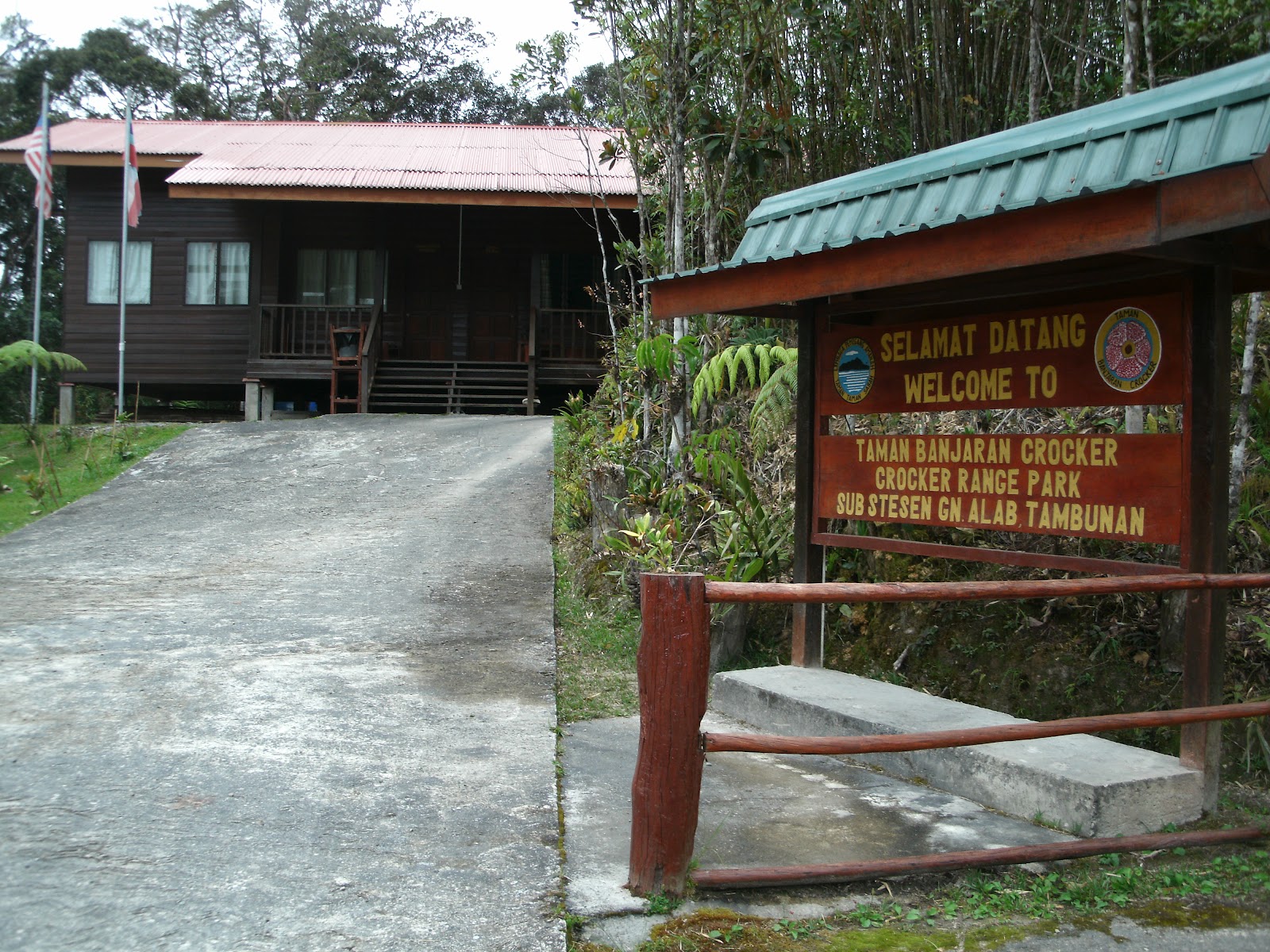
Crocker Range Park

Habitat: lowland dipterocarp forest on steep slopes, disturbed in the vicinity of the station.
Facilities: Sabah Parks Office, four large dormitories. Expedition members will stay at the chalets (20 persons max.) and in the hostel (30 persons). Mobile phone reception (Celcom, Digi, Maxis) is fair.
Trails: circular "night walking" trail (400 m), longer trail down to the waterfall, start of the "salt trail", 4 days' walk across the Crocker Range to Tambunan.
Access: 4-wheel drive only; ca. 15 km from the old Papar road at Penampang.

Mahua (1000 m a.s.l.)
Habitat: lower montane forest on steep slopes on either side of Mahua river and Waterfall.
Facilities: Sabah Parks office, two large dormitories, large restaurant, camp site. No camp for the expedition participants will be built here, because the station is easily accessible from the Gunung Alab station. Therefore, day trips will be made to Mahua from there. Mobile phone reception is very poor.
Trails: trail (ca. 500 m) along the river, short ("Rafflesia") trail up the north-facing slope of the gully, start of the 20-km-long trail to Gunung Alab substation.
Access: via surfaced road from Kg. Mahua along the Ranau-Tambunan road; accessible in regular car.
Note: crowded with day-trippers during weekends.
Habitat: acidic low-crowned montane forest, patches of secondary growth near the station.
Facilities: Cabins, chalet, and staff quarters available for 26 - 28 persons. Mobile phone reception (Celcom, Digi, Maxis) is good.
Trails: two short loop-trails around the station, a third surfaced loop-trail through the "Nepenthes Garden"; start of the 20-km-long trail to Mahua substation (first 2 km wide, after that the trail becomes narrower, but said to be well-maintained throughout).
Access: via steep, mostly surfaced road from the Gunung Alab resthouse along the KK-Tambunan road. 4-Wheel drive vehicle recommended.
Kinabalu Park
(descriptions under construction)
Poring (550 m a.s.l.)
Habitat:lowland dipterocarp forest on hill slopes. The Mamut river passes by the station and the Kipungit waterfall is nearby. Around the station are hot-water springs that have been developed into swimming pools and baths.
Facilities: Extensive infrastructure (exhibition space, restaurant, chalets, butterfly house, canopy walkway) to accommodate the visitors to the hot springs. Expedition members will stay at the cabin and staff quarters (14 - 18 persons). There is a kitchen. Mobile phone reception (Digi, Celcom, Maxis) is good.
Trails: A short loop trail leads to the canopy walkway. A longer trail leads first to the Kipungit waterfall and then steeply uphill towards the Langanan waterfall. The climb leads, via a band of forest on ultramafic soil, to lower montane forest.
Access: via a good side-road that leads from the main Ranau-Sandakan road.
Sayap (1070 m a.s.l.)
Habitat: Hill-dipterocarp forest with oaks, chestnuts, and figs. After dipterocarps, the commonest families are Euphorbiaceae and Annonaceae.
Facilities: The station itself consists of an office and a small dorm. For the expedition members, an expedition camp is available for 25 persons, with an outside bathroom and an outside kitchen. Mobile phone reception is very poor.
Trails: The abandoned logging road crosses the Kemantis stream, and ends 1 km ahead at the Lumutok Kecil stream. Loop-trails of 500-1000 m each leave from the old logging road; some are quite steep in parts. Two longer trails (Minodtuhan and Tepisung trail) that follow streams uphill are also available.
Access: Sayap lies about two hours drive from Kota Kinabalu in good weather with a four wheel drive vehicle. To reach it one must drive north to Kota Belud, go through the town, and after crossing the Tempasuk river, take the right turn to "Kem Paradise", the army camp. After 30 km, the twon of Sayap is reached. Six km past Sayap, the park boundary is crossed, and a few minutes' drive on, the substation comes into view. (Adapted from Phillips & Liew, A Visitor's Guide to Kinabalu Park.)
Park Headquarters (1500 m a.s.l.)
Habitat: Lower montane forest
Facilities: The headquarters area is very large, with several buildings (chalets, visitors' centres, admin buildings, staff quarters, restaurants) and botanical gardens. During the expedition, we will stay at the Guest House, Pnataran Cabin, and Basement (28-32 persons). Mobile phone reception (Celcom, Digi, Maxis) is good.
Trails: A network of roads connects the buildings, and a well-developed network of longer and shorter trails surrounds the headquarters area, a few of which (Liwagu River trail, Kiau View trail) are longer and link up with the main road that leads uphill to the Power Station and the Timpohon Gate at 1,900 m elev.
Access: Via the main Kota Kinabalu-Ranau road.
Layang-Layang (2700 m a.s.l.)
Habitat: Upper montane forest
Facilities: Mobile phone reception (Celcom, Digi, Maxis) is good. Expedition members will stay in the cabin (8-10 persons), which has a kitchenette and an outside bathroom.
Trails:
Access: On foot from Timpohon Gate (20 min. drive from Park Headquarters)
Laban Rata / Burlington Hut (3300 m a.s.l.)
Habitat:
Facilities: 8 - 10 persons can stay in the "Burlington hut", which has a kitchenette and an outside bathroom. Mobile phone reception (Celcom, Digi, Maxis) is good.
Trails:
Access: On foot from Layang-Layang
Informative post ..Dear here i would like to tell you that ..in uk .there is another company which provide Substations at very reasonable price...Thanks
ReplyDelete